Trips
SR 839 to Finger Rock Road
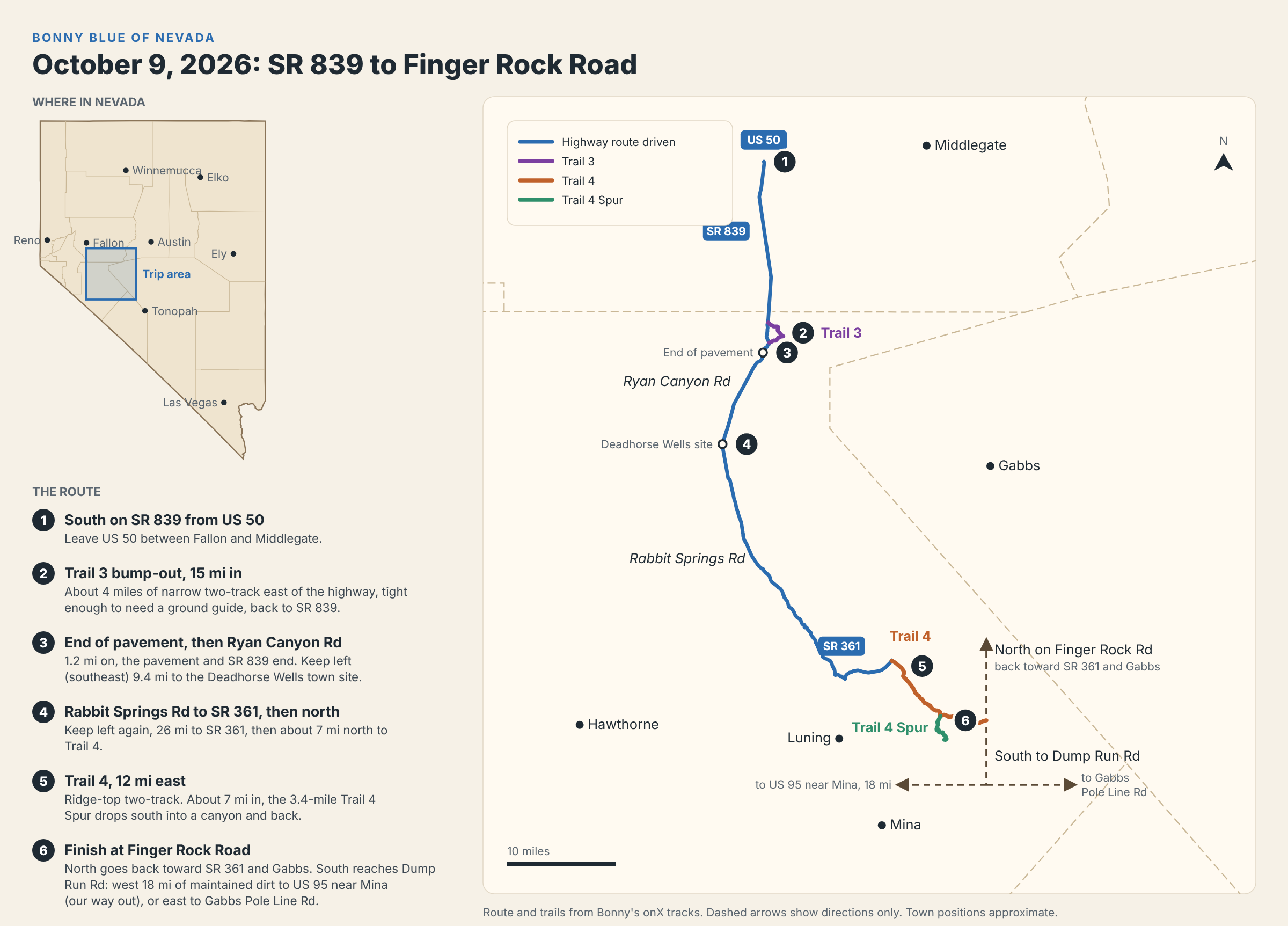
We left US 50 between Fallon and Middlegate heading south on SR 839. About 15 miles in, we took the Trail 3 bump-out: roughly 4 miles of narrow two-track east of the highway, tight enough in places that we needed a ground guide, before it dropped us back on SR 839.
From there it was another 1.2 miles south to where the pavement ended, and so too did the official SR 839. Keeping slightly left (southeast) to stay on Ryan Canyon Road for 9.4 miles brought us to what some maps show as the Deadhorse Wells town site.
We again stayed left (southeast) onto Rabbit Springs Road, 26 miles to SR 361, then about 7 miles north on 361 to the start of Trail 4. Trail 4 runs 12 miles east along a ridge-top two-track. About 7 miles in, the Trail 4 Spur drops 3.4 miles south into a canyon and back, and it's worth the detour.
Trail 4 ends at Finger Rock Road, where you have options. North takes you back toward SR 361 and Gabbs. South leads to Dump Run Road, which heads west to US 95 near Mina (18 miles of maintained dirt road, this is how we got out) or east to Gabbs Pole Line Road.
Routes are posted on onX as Bonny Blue Trail 3, Trail 4 and Trail 4 Spur.
Arizona Peace Trail
A roughly 675-mile loop of mostly BLM backcountry through western Arizona. The plan is to drive it in daily sections over a few days, stopping in towns like Oatman, Lake Havasu City and Quartzsite. Trip report to follow.